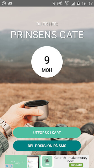
We provide Above - Height Above Sea Level online (apkid: no.aboveapps.above) in order to run this application in our online Android emulator.
Description:

Run this app named Above - Height Above Sea Level using MyAndroid.
You can do it using our Android online emulator.
Important Notice:
This app is not affiliated with, approved by, or developed in collaboration with any government agency.
It uses open public data from the Norwegian Mapping Authority (Kartverket), which is freely available through official datasets and APIs (www.kartverket.no).
Above is a Norwegian-developed app that shows you accurate elevation data for all of Norway.
Unlike other apps, Above uses the DTM10 terrain model from the Norwegian Mapping Authority (Statens kartverk), which provides detailed elevation data based on a 10 10 meter grid.
You can also share your location via SMS a helpful feature if you're unsure of your position or simply want to save the coordinates of a location for later use.
The background map in Above is a unique blend of the Norwegian Mapping Authority's topographic map and custom hillshading, making it easier to understand the terrain visually.
All place names are sourced from SSR (Central Place Name Register), also provided by Kartverket.
Kartverket data used in accordance with the Norwegian Licence for Open Government Data (NLOD).
Privacy Policy:
https: //aboveapps.no/personvern-for-above/
MyAndroid is not a downloader online for Above - Height Above Sea Level. It only allows to test online Above - Height Above Sea Level with apkid no.aboveapps.above. MyAndroid provides the official Google Play Store to run Above - Height Above Sea Level online.
©2025. MyAndroid. All Rights Reserved.
By OffiDocs Group OU – Registry code: 1609791 -VAT number: EE102345621.
