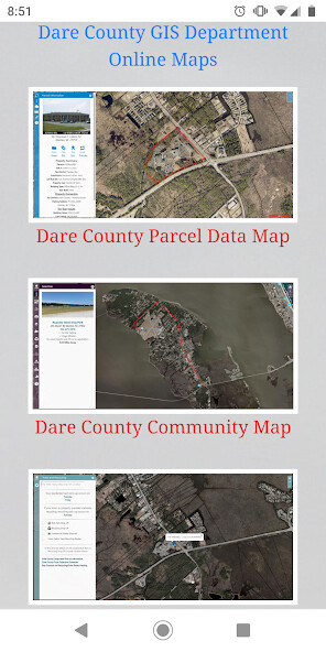
We provide Dare County GIS online (apkid: gov.darecountync.gis) in order to run this application in our online Android emulator.
Description:

Run this app named Dare County GIS using MyAndroid.
You can do it using our Android online emulator.
A landing page for all available Dare County North Carolina GIS department online web maps.
The web maps included are the Dare County Parcel Data Map, Dare County Community Map, OBX Trash Map, Beach Nourishment Map, Dare County Duck Blinds Map and GIS Day 2019 - A Look Back to 1996.
You can also find a list of Dare County GIS Department staff members and how to contact them.
The web maps included are the Dare County Parcel Data Map, Dare County Community Map, OBX Trash Map, Beach Nourishment Map, Dare County Duck Blinds Map and GIS Day 2019 - A Look Back to 1996.
You can also find a list of Dare County GIS Department staff members and how to contact them.
MyAndroid is not a downloader online for Dare County GIS. It only allows to test online Dare County GIS with apkid gov.darecountync.gis. MyAndroid provides the official Google Play Store to run Dare County GIS online.
©2025. MyAndroid. All Rights Reserved.
By OffiDocs Group OU – Registry code: 1609791 -VAT number: EE102345621.