
We provide Geolantis.360 online (apkid: geolantis.collector) in order to run this application in our online Android emulator.
Description:
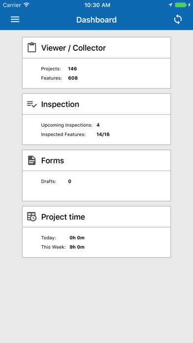
Run this app named Geolantis.360 using MyAndroid.
You can do it using our Android online emulator.
Geolantis.360 is an advanced GPS software for professional field operators who need to collect accurate information of assets, utilities and other location related information.
The mobile Geolantis app allows a field worker to visualize their position relative to existing infrastructure, access attached project documents or photos and gives the ability to update location coordinates.
In addition, Geolantis supports taking geo-referenced photos, filling electronic forms and creating field notes or site sketches, all before submitting the information to the Geolantis.360 cloud portal.
In order to use the app you have to activate an account on the Geolantis.360 website.
Sign-up for a free 14-day trial.
Geolantis.360
Minimizes damages on critical infrastructure (utility strikes)
Integrate seamlessly with GNSS and cable locators
Work with survey grade, CAD & GIS data in one platform
Allows capture of accurate location data
Sync data in real-time to the web portal
Improves field to office communications
Features include:
GIS data collection
Capture point, line, polygon features incl.
attribute data
Manual or GNSS (GPS) based data acquisition
Capture photos & sketches
Photo annotations
Stake-out
Fill out electronic forms
Mapped data is directly visualized on top of various basemaps
Manage layers
Basemap providers include OpenStreetMap, Google Maps, Satellite maps,.
Data is synced to the Geolantis.360 web portal
Works online and offline
Pro features include:
Connect to cable locators from Radiodetection, Vivax Metrotrech, Leica, Subsite
Auto mapping (measure every x meters)
Parallel line mapping
The web portal allows to:
Setup the data collection feature type catalogue
Manage data collection projects
Visualize data on various background maps
Importing existing CAD & GIS data in various formats like SHP, DXF, DWG, KML, CSV
Review and export the captured field data to various formats like SHP, DXF, DWG, KML, CSV
Manage online services like WFS, WMS, WMTS
Manage users
Manage coordinate systems
How it works:
Setup the data collection catalogue in the web portal
Create a project
Data is synced automatically to the mobile app
Collect field data & Capture photos
Data is automatically synced back to the server
Review, analyze and export the data
The app can be used with the devices internal location provider and with external high-precision GNSS receivers.
Geolantis.360 is a fully integrated management solution for contractors, network operators, utilities, telcos, surveying & maintenance crews or anyone who needs to manage field crews.
It allows to manage employees, customers, projects, smart forms, checklists, data collection, maps, places, equipment, tasks, documents and more.
Geolantis.COLLECTOR is a mobile application and is part of the Geolantis.360 platform which allows managing your field data collection projects.
The mobile Geolantis app allows a field worker to visualize their position relative to existing infrastructure, access attached project documents or photos and gives the ability to update location coordinates.
In addition, Geolantis supports taking geo-referenced photos, filling electronic forms and creating field notes or site sketches, all before submitting the information to the Geolantis.360 cloud portal.
In order to use the app you have to activate an account on the Geolantis.360 website.
Sign-up for a free 14-day trial.
Geolantis.360
Minimizes damages on critical infrastructure (utility strikes)
Integrate seamlessly with GNSS and cable locators
Work with survey grade, CAD & GIS data in one platform
Allows capture of accurate location data
Sync data in real-time to the web portal
Improves field to office communications
Features include:
GIS data collection
Capture point, line, polygon features incl.
attribute data
Manual or GNSS (GPS) based data acquisition
Capture photos & sketches
Photo annotations
Stake-out
Fill out electronic forms
Mapped data is directly visualized on top of various basemaps
Manage layers
Basemap providers include OpenStreetMap, Google Maps, Satellite maps,.
Data is synced to the Geolantis.360 web portal
Works online and offline
Pro features include:
Connect to cable locators from Radiodetection, Vivax Metrotrech, Leica, Subsite
Auto mapping (measure every x meters)
Parallel line mapping
The web portal allows to:
Setup the data collection feature type catalogue
Manage data collection projects
Visualize data on various background maps
Importing existing CAD & GIS data in various formats like SHP, DXF, DWG, KML, CSV
Review and export the captured field data to various formats like SHP, DXF, DWG, KML, CSV
Manage online services like WFS, WMS, WMTS
Manage users
Manage coordinate systems
How it works:
Setup the data collection catalogue in the web portal
Create a project
Data is synced automatically to the mobile app
Collect field data & Capture photos
Data is automatically synced back to the server
Review, analyze and export the data
The app can be used with the devices internal location provider and with external high-precision GNSS receivers.
Geolantis.360 is a fully integrated management solution for contractors, network operators, utilities, telcos, surveying & maintenance crews or anyone who needs to manage field crews.
It allows to manage employees, customers, projects, smart forms, checklists, data collection, maps, places, equipment, tasks, documents and more.
Geolantis.COLLECTOR is a mobile application and is part of the Geolantis.360 platform which allows managing your field data collection projects.
MyAndroid is not a downloader online for Geolantis.360. It only allows to test online Geolantis.360 with apkid geolantis.collector. MyAndroid provides the official Google Play Store to run Geolantis.360 online.
