
We provide Compass Level Chart online (apkid: com.hsi.mobile.compass.level.chart) in order to run this application in our online Android emulator.
Description:

Run this app named Compass Level Chart using MyAndroid.
You can do it using our Android online emulator.
The top row displays the X(horizontal) and Y(vertical) levels both in degrees and percent.
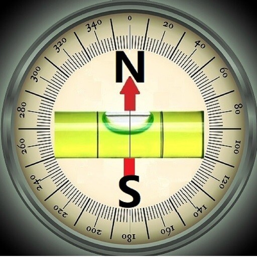
The left circle simulates a water bubble inside a ground level meter.
The compass uses the top center as north.
Upon start, it will start collecting one set of data every 0.2 seconds.
Each set of data has the X degree, Y degree, and Compass angle.
The chart stores and displays the latest 100 data sets, and old data will be deleted.
[STOP] will stop the sampling and plotting.
[RESET] will clear the list of data.
[ADD] will add one data set per click.
[DELETE] will delete one set of data.
The maximum value of each component is displayed in each section.
Y(max) shows the maximum value of all Y data in the chart.
X(max) is the maximum value of all X data.
Since the Compass measurement may be affected by all neighboring magnetic components, calibration is necessary and should be done frequently.
To calibrate, simply move the phone in a figure 8 pattern, like writing the letter '8' with the phone in the air.
Swing the phone back and forth a couple of times and it will calibrate the compass.
This program samples data continuously, and the calibration can be done when the program is active.
The basic idea is to let the magnetic sensor establish a 3D reading of the phone environment to derive the North direction.
The program will run continuously in the background until closed.
MyAndroid is not a downloader online for Compass Level Chart. It only allows to test online Compass Level Chart with apkid com.hsi.mobile.compass.level.chart. MyAndroid provides the official Google Play Store to run Compass Level Chart online.
