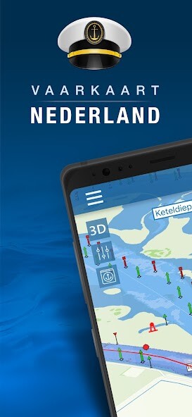
We provide Nautical map (The Netherlands) online (apkid: nautical.map.the.netherlands) in order to run this application in our online Android emulator.
Description:

Download this app named Nautical map (The Netherlands).
Nautical map (The Netherlands) is an online waterway chart and almanac which immediately displays all information relevant when traveling over water in The Netherlands.It is also an great tool to plan your cruise.
Nautical map NL includes:
- More than 8,000 buoys, barrels and other floating waterway markings.
- More than 4,500 docks and warfs.
- More than 2,500 bridges, including height, width and operating times.
- More than 300 locks including operating times.
- Display of current speed and course.
- Graphical representation of the traveled route.
Agreements: http: //www.vaarkaartnederland.nl/voorwaarden
Updates:
- Tonen van schepen in de buurt dmv AIS- Tonen van real-time scheepvaartberichten / stremmingen
- Mogelijkheid om opmerkingen toe te voegen aan een object
- Nog meer nieuwe gegevens toegevoegd aan de kaart
Free download Android Nautical map (The Netherlands) from MyAndroid.net
MyAndroid is not a downloader online for Nautical map (The Netherlands). It only allows to test online Nautical map (The Netherlands) with apkid nautical.map.the.netherlands. MyAndroid provides the official Google Play Store to run Nautical map (The Netherlands) online.
©2025. MyAndroid. All Rights Reserved.
By OffiDocs Group OU – Registry code: 1609791 -VAT number: EE102345621.